Update:
This is a developing story that will be updated continuously.
The cold weather and icy conditions coating North Texas are likely to continue through Thursday morning leading the National Weather Service to extend its winter weather storm warning.
The warning, originally set to last through Wednesday, is now set to expire at 6 a.m. Thursday.
The storm — which brought freezing rain, sleet, and iced-over roadways, to the region Monday — caused schools and businesses to close, canceled flights out of DFW International and Love Field airports, and sent cars sliding on the highways.
“Widespread icing on bridges and overpasses as well as surface streets is expected with travel significantly impacted,” the weather service said. “There is a low chance of some downed powerlines and tree damage due to ice.”
Live radar can be viewed below, along with the latest updates from reporters at The Dallas Morning News:
The Dallas Fort-Worth area set a new daily record for snowfall as sleet and freezing rain coated parts of North Texas on Tuesday.
The weather service said the Metroplex set a record of 1.3 inches of snow thus far, breaking a record from three decades prior. The last time the region saw this much snowfall – or sleet on the ground – was in 1985 with 1.2 inches.
While all of the precipitation may not have been actual snowfall, the weather service said sleet on the ground counts “for the purpose of record keeping.”
The weather service issued an ice storm warning for parts of North Texas near I-35W and counties west of Dallas.
Light freezing rain and sleet will continue tonight and transition to mainly freezing rain on Wednesday, according to the weather service.
Ice Storm Warning is now in effect for I-35W and westward. This is for a half inch of ice accumulation Wednesday PM into early Thursday resulting in tree breakage and localized power outages. Winter Storm Warning continues elsewhere for persisting hazardous travel. #dfwwx #ctxwx pic.twitter.com/U784AMWGG0
— NWS Fort Worth (@NWSFortWorth) January 31, 2023
The warning, which is in effect until Thursday morning, applies to Comanche, Denton, Eastland, Erath, Hood, Jack, Johnson, Palo Pinto, Parker, Somervell, Stephens, Tarrant, Wise and Young counties. About half an inch of ice could build up on trees and power lines, according to the weather service.
It said to prepare for the power to go out and for tree limbs to break. Travel could be “nearly impossible through Wednesday night,” the weather service said.
Dallas County is still under a winter storm warning.
In Austin, Gov. Greg Abbott warned of dangerous driving conditions and touted the effectiveness of the state’s power grid.
Sitting alongside state agency officials, Abbott said at a news conference that more than 1,600 roads across the state have been affected by the weather.
Abbott said many roads will remain treacherous for up to the next 48 hours. State officials advised Texans to avoid driving — but to slow down if they must go on the roads.
A state trooper was also injured while responding to a roadside incident, said Col. Steven McCraw, director of the Texas Department of Public Safety. He didn’t provide any more details other than it took about 90 minutes to get the trooper to a hospital.
Power grid officials and the governor said outages have been localized and that people without electricity should reach out to their local power provider. Still, Abbott said, the power grid is functioning “very effectively.”
About 17,000 customers were without power in Texas as of Tuesday, according to poweroutage.us.
A 45-year-old man died in an accident in Arlington Monday night after losing control of his vehicle on the icy road.
The man, who has not been identified, was headed east on I-20 at about 8:45 p.m. when he lost control of his SUV crossing the Green Oaks Boulevard overpass. The car slid into the guardrail, went airborne and rolled down an embankment, police said.
The man, who was ejected from the vehicle, died later at the hospital. Police say he was not wearing a seatbelt.
A stretch of northbound I-35W at Crawford Road in Denton is reopen after a jackknifed 18-wheeler forced it to close Tuesday morning, Denton police said on Twitter.
The City of Dallas’ garbage and recycling collection was canceled Tuesday due to road conditions, officials said. It was unclear if the pickups would resume Wednesday.
The storm shifted over Dallas, bringing with it light to moderate sleet and freezing rain in some areas, according to the weather service. Sleet accumulation could increase to a half-inch or inch.
10:38 AM: This line of light to moderate sleet has shifted east and is over the Dallas side of the Metroplex, over areas north and east. Expect sleet accumulations of up to 0.5 inches, perhaps up to 1 inch. Freezing rain could be falling with this as well. #dfwwx #txwx pic.twitter.com/PZVeV5MOVo
— NWS Fort Worth (@NWSFortWorth) January 31, 2023
A stretch of northbound I-35W in Denton is closed due to a jackknifed 18-wheeler blocking all lanes, Denton police said on Twitter. Traffic is being diverted at the Crawford exit to Highway 377.
Lanes will be closed until at least 11:30 a.m. Drivers should seek alternate routes, police say.
DFW International Airport said on Twitter that it is monitoring the forecast and treating runways, roads, bridges and pedestrian walkways for ice.
Passengers should check their flight status with the airline before heading to the airport, allow extra time to get there and approach entrance plazas with caution, the airport said.
By mid-morning Tuesday, more than one-third of flights in and out of DFW and Dallas Love Airport had been canceled, according to FlightAware, a flight tracking site.
The hazardous road conditions caused several city buildings to close Tuesday, including Dallas Municipal Court and all recreation centers.
As of 8:15 a.m., city libraries — which double as warming centers during inclement weather — are set to open at noon, but city officials say people should call locations ahead of time to verify they’re open before heading over.
Additionally, a scheduled city council committee meeting scheduled for 9 a.m. Tuesday was postponed until Feb. 7.
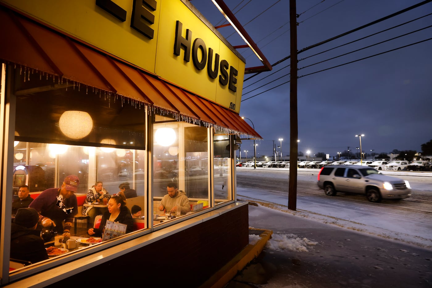
The Kroger on E. Mockingbird Lane was open for business despite the icy roads surrounding it Tuesday morning. The parking lot was a mix of slush and newly fallen freezing rain.
About a dozen customers walked through the aisles, grabbing last-minute foods and necessities as an intercom announcement echoed: “Attention employees: Please report to Starbucks for a free coffee.”
The nearby 7/11 at the corner of Greenville Avenue was also open for customers needing to fill up on coffee or gas.
Just after 7:30 a.m., the National Weather Service said a “moderate band” of sleet was beginning to move through the metroplex, in addition to areas both west and east.
The weather service said to expect a few isolated thunderstorms with bursts of both sleet and freezing rain to continue throughout the morning, adding sleet accumulations will “average a quarter of an inch, with isolated totals up to one inch.”
“This will lead to ice packed roads and treacherous driving conditions,” the weather service said.
In the Hollywood-Santa Monica neighborhood of East Dallas, on the edge of Lakewood, the “thunder sleet” began falling at 7:50 a.m. so furiously that in three minutes, the roads and rooftops went from looking completely clear to covered in white.
As Dallas Morning News columnist Sharon Grigsby described the scene: “It sounds like glass breaking on the roof.”
North Texans have been urged to stay home throughout the storm if possible, but Dallas city officials said for those still needing to make a commute, TxDOT work crews are on 24-hour shifts to treat roads and highways.
Madison Schein, a TxDOT Dallas spokeswoman, said people who have to drive should plan routes ahead of time and to look for information on drivetexas.org.
“We started pretreating roads with brine a few days ago and we’re continuing with brine,” Schein said. “Now we’re doing salt and sand mix as needed and we’ll continue to adjust our operations as the storm moves through our area.”
The city said it will also be using a salt and sand mixture to treat roads close to emergency facilities and icy bridges.
Hundreds of drivers were in a multi-hour gridlock Tuesday morning on Interstate 20 in Palo Pinto and Parker counties. The traffic resulted in at least a 20-mile backup, KDFW-TV reported.
Traffic Alert (Parker County) Eastbound I20 west of Weatherford has been gridlocked for hours due to "treacherous conditions impacting travel," says TxDOT. Many residents have sat in traffic going on 4+ hours with no relief in sight. pic.twitter.com/RnuQmhuT7k
— DFW Scanner (@DFWscanner) January 31, 2023
In the Fort Worth area, there were more than 140 reported motor vehicle collisions with reported injuries as of 5 a.m. Tuesday, including 16 were rollover crashes, according to Matt Zavadsky, a spokesman for MedStar.
There were also eight hypothermia-related calls, Zavadsky said. Seven people required hospitalization and five of those were in serious condition.
In addition, nine people were injured in falls from slipping on ice, Zavadsky said.
“Out of an abundance of caution,” Zavadsky said MedStar suspended the use of lights and siren responses as of 11:30 p.m. Monday to prevent crashes as motorists attempt to move out of the way for ambulances.
“An ambulance that does not arrive on the scene of an emergency is not able to help patients,” he said. “It’s better, and safer, to respond a little slower, assure we arrive, and don’t cause any injuries on the way to the call.”
The Public Utility Commission of Texas and Electric Reliability Council of Texas, or ERCOT, the state’s main grid operator, have said they expect the grid to be able to handle “forecasted demand” brought on by this week’s storm.
In a written statement Monday afternoon, Peter Lake, the chairman of the utility commission, echoed ERCOT’s message and said people should continue reporting local outages.
“Our biggest concern is power line safety, especially in areas that experience icing,” Lake wrote. “Ice can weigh down lines and topple tree limbs causing local power outages.”
The forecast calls for more sleet and freezing rain Tuesday with temperatures hovering in the high 20s all day. Up to a half inch of ice could accumulate.
Travel has the potential to become “life-threatening,” according to the weather service. Road conditions could improve by the afternoon, but water on the roads could freeze once again overnight, worsening conditions for Wednesday morning.
These conditions continue Wednesday before warming up to the 40s with rain on Thursday. The weekend should be sunny with temperatures in the 50s and 60s.